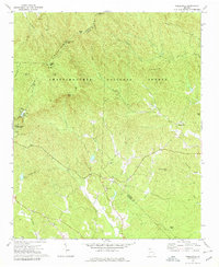
1971 Map of Nimblewill
USGS Topo · Published 1979About this map
Amicalola Falls State Park defines the western portion of this 1970s survey, where the dramatic descent of Amicalola Falls meets a network of recreation areas and campgrounds. The landscape is dominated by the ridges of the Chattahoochee National Forest, featuring prominent peaks such as Springer Mtn, Bull Mtn, and Frosty Mtn, the latter of which is marked by a Lookout Tower.
Find a feature on this map
42 named features on this map. Tap any name to fly to it.
Don’t see what you’re looking for? This feature index may not catch every label — zoom into the map to look around manually.
Map Details
Editions of this 1971 Nimblewill Map
4 editions found
Other maps of this area

1888 · Ellijay
USGS Topo · 1:125,000

1890 · Suwanee
USGS Topo · 1:125,000

1892 · Ellijay
USGS Topo · 1:125,000

1894 · Suwanee
USGS Topo · 1:125,000

1898 · Ellijay
USGS Topo · 1:125,000

1911 · Ellijay
USGS Topo · 1:125,000

1926 · Tate
USGS Topo · 1:62,500

1928 · Tate
USGS Topo · 1:62,500

1935 · Noontootla
USGS Topo · 1:24,000

1935 · Tickanetley
USGS Topo · 1:24,000