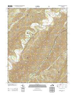
2013 Map of Nimrod Hall
USGS Topo · Published 2013About this map
The Cowpasture River defines the valley of this Bath County landscape, winding past the historic settlement of Nimrod Hall. This area is characterized by its recreational and residential clusters, notably the Boys Camp, Bible Camp, and Camp Kannata situated along the riverbanks. The terrain is dominated by significant ridgelines such as Rough Mountain and Short Mountain, with the Mason Tunnel cutting through the topographic features to the northeast. To the south, the community of Copeland sits near the confluence of S Fork Pads Cr and Pads Cr. The road network, including State Rte 42 and Nimrod Dr, follows the natural contours of the river valley and the base of Griffith Knob, illustrating how geography has dictated local transport and settlement patterns in this part of Virginia.
Find a feature on this map
26 named features on this map. Tap any name to fly to it.
Don’t see what you’re looking for? This feature index may not catch every label — zoom into the map to look around manually.
Map Details
Editions of this 2013 Nimrod Hall Map
This is the sole edition of this map. No revisions or reprints were ever made.
Other maps of this area

1894 · Natural Bridge
USGS Topo · 1:125,000

1901 · Monterey
USGS Topo · 1:125,000

1923 · Warm Springs
USGS Topo · 1:48,000

1926 · Warm Springs
USGS Topo · 1:62,500

1930 · Warm Springs Run
USGS Topo · 1:24,000

1931 · Healing Springs
USGS Topo · 1:24,000

1933 · Warm Springs Run
USGS Topo · 1:31,680

1933 · Healing Springs
USGS Topo · 1:31,680

1945 · Clifton Forge
USGS Topo · 1:62,500

1946 · Millboro
USGS Topo · 1:62,500