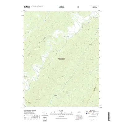
2019 Map of Nimrod Hall
USGS Topo · Published 2019About this map
The Cowpasture River carves a winding path through this corner of the George Washington National Forest, where the complex topography of the Ridge-and-Valley province is on full display. Small riverside settlements like Nimrod Hall and Copeland are situated along the valley floor, connected by State Rte 632. The map illustrates a landscape of significant relief, including Beards Mtn and Mill Mtn, separated by deep drainage features such as Hickman Draft. Cultural markers are sparse but notable, including the Mason Tunnel near the eastern edge and the Orebank Trl which hints at the area's historical extraction or transport routes. Along the northern border, Millboro Springs serves as a small hub where Mill Cr and Stuart Run converge, while the southern reaches are dominated by the heights of Brushy Mtn near the Rockbridge County line.
Find a feature on this map
36 named features on this map. Tap any name to fly to it.
Don’t see what you’re looking for? This feature index may not catch every label — zoom into the map to look around manually.
Map Details
Editions of this 2019 Nimrod Hall Map
This is the sole edition of this map. No revisions or reprints were ever made.
Other maps of this area

1894 · Natural Bridge
USGS Topo · 1:125,000

1901 · Monterey
USGS Topo · 1:125,000

1923 · Warm Springs
USGS Topo · 1:48,000

1926 · Warm Springs
USGS Topo · 1:62,500

1930 · Warm Springs Run
USGS Topo · 1:24,000

1931 · Healing Springs
USGS Topo · 1:24,000

1933 · Warm Springs Run
USGS Topo · 1:31,680

1933 · Healing Springs
USGS Topo · 1:31,680

1945 · Clifton Forge
USGS Topo · 1:62,500

1946 · Millboro
USGS Topo · 1:62,500