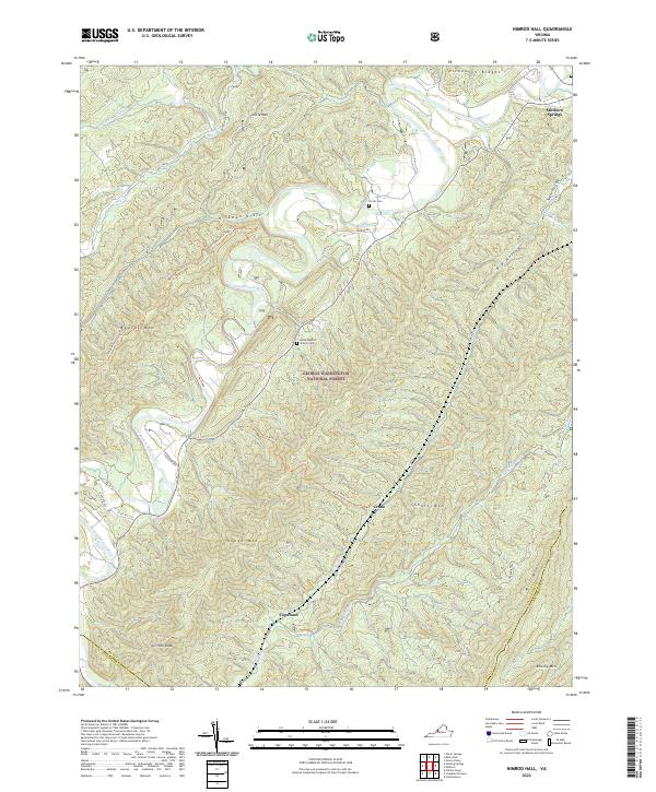
2022 Map of Nimrod Hall
USGS Topo · Published 2022About this map
The Cowpasture River winds through a landscape of prominent ridges and deep hollows within the George Washington National Forest. Small settlements like Millboro Springs and Copeland are situated along the valley floors, while historic sites such as Horeb Baptist Church Cem and Porter Cem offer clues for genealogical research. The terrain is defined by massive formations including Rough Mtn, Beards Mtn, and Mill Mtn, separated by features like Sugar Hollow and Hickman Draft. This map documents a region where the human footprint is primarily concentrated along the river and its tributaries, such as Pauls Cr and Lick Run. An extensive network of paths, including the Beards Mountain Trl and Orebank Trl, provides access through the protected forest lands and across the county lines of Bath, Alleghany, and Rockbridge.
Find a feature on this map
38 named features on this map. Tap any name to fly to it.
Don’t see what you’re looking for? This feature index may not catch every label — zoom into the map to look around manually.
Map Details
Editions of this 2022 Nimrod Hall Map
This is the sole edition of this map. No revisions or reprints were ever made.
Other maps of this area

1894 · Natural Bridge
USGS Topo · 1:125,000

1901 · Monterey
USGS Topo · 1:125,000

1923 · Warm Springs
USGS Topo · 1:48,000

1926 · Warm Springs
USGS Topo · 1:62,500

1930 · Warm Springs Run
USGS Topo · 1:24,000

1931 · Healing Springs
USGS Topo · 1:24,000

1933 · Warm Springs Run
USGS Topo · 1:31,680

1933 · Healing Springs
USGS Topo · 1:31,680

1945 · Clifton Forge
USGS Topo · 1:62,500

1946 · Millboro
USGS Topo · 1:62,500