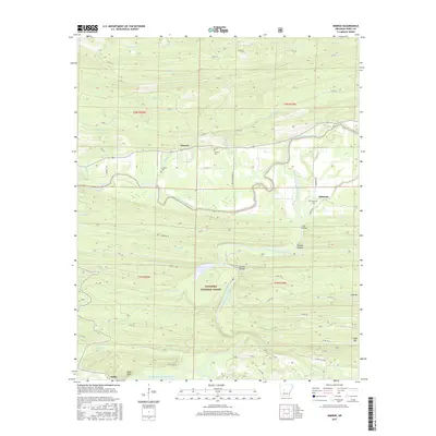
2017 Map of Nimrod
USGS Topo · Published 2017About this map
Ouachita National Forest dominates the southern landscape of this Arkansas region, where the terrain is defined by the winding paths of the Fourche LaFave River and its southern fork. The settlement pattern is largely rural and dispersed, centered around small communities like Nimrod and Deberrie. This map provides significant detail for genealogists, documenting the locations of several burial grounds including Nimrod Cem, Garland Cem, and Deberrie Cem. The topography is marked by distinctive hollows and bluffs, such as Long Hollow and the prominent Goat Bluff overlooking the river near Hollis. Water features are abundant, from the central Cove Cr Lake to numerous named tributaries like Cherry Br and Caney Cr, which carve through the elevations of Link Mtn and Cedar Mtn.
Find a feature on this map
58 named features on this map. Tap any name to fly to it.
Don’t see what you’re looking for? This feature index may not catch every label — zoom into the map to look around manually.
Map Details
Editions of this 2017 Nimrod Map
This is the sole edition of this map. No revisions or reprints were ever made.
Other maps of this area

1888 · Dardanelle #4
USGS Topo · 1:62,500

1889 · Morrilton No. 3
USGS Topo · 1:62,500

1890 · Benton
USGS Topo · 1:125,000

1890 · Hot Springs
USGS Topo · 1:125,000

1890 · Dardanelle
USGS Topo · 1:125,000

1892 · Morrillton
USGS Topo · 1:125,000

1894 · Morrillton
USGS Topo · 1:125,000

1894 · Hot Springs
USGS Topo · 1:125,000

1894 · Benton
USGS Topo · 1:125,000

1955 · Little Rock
USGS Topo · 1:250,000