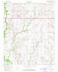
1956 Map of Ninemile Creek
USGS Topo · Published 1971About this map
Fort Sill Indian School Reservation occupies the northwest corner of this landscape, marking a significant institutional presence in Comanche County during the mid-20th century. The terrain is defined by the convergence of East Cache Creek and its namesake tributary, Ninemile Creek. While much of the area reflects rural land use, the proliferation of oil wells and infrastructure such as a Substation and Pump house indicates an active energy extraction economy.
Find a feature on this map
21 named features on this map. Tap any name to fly to it.
Don’t see what you’re looking for? This feature index may not catch every label — zoom into the map to look around manually.
Map Details
Editions of this 1956 Ninemile Creek Map
3 editions found
Other maps of this area

1946 · Lawton
USGS Topo · 1:62,500

1949 · Arbuckle Hill
USGS Topo · 1:24,000

1949 · Fort Sill
USGS Topo · 1:24,000

1949 · Nellie
USGS Topo · 1:62,500

1955 · Lawton
USGS Topo · 1:250,000

1956 · Sterling
USGS Topo · 1:24,000

1956 · Ninemile Creek
USGS Topo · 1:24,000

1956 · Arbuckle Hill
USGS Topo · 1:24,000
1956 · Fort Sill
USGS Topo · 1:24,000

1956 · Lawton
USGS Topo · 1:24,000