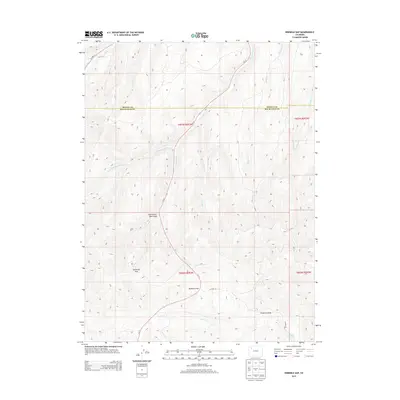
2013 Map of Ninemile Gap
USGS Topo · Published 2013About this map
Ninemile Gap serves as a prominent geographic waypoint in this portion of Northwest Colorado, where the high ridges of the Danforth Hills dictate the movement of local travel and water. The landscape is defined by an intricate drainage system including Good Spring Cr, Elkhorn Cr, and the appropriately named Ninemile Draw. In the southern reaches, the Langley Reservoir provides a concentrated water source amidst the network of gulches and creeks.
Find a feature on this map
21 named features on this map. Tap any name to fly to it.
Don’t see what you’re looking for? This feature index may not catch every label — zoom into the map to look around manually.
Map Details
Editions of this 2013 Ninemile Gap Map
This is the sole edition of this map. No revisions or reprints were ever made.
Other maps of this area

1910 · Danforth Hills
USGS Topo · 1:125,000

1912 · Meeker
USGS Topo · 1:62,500

1912 · Axial
USGS Topo · 1:62,500

1914 · Meeker
USGS Topo · 1:62,500

1914 · Axial
USGS Topo · 1:62,500

1915 · Monument Butte
USGS Topo · 1:62,500

1954 · Craig
USGS Topo · 1:250,000

1957 · Craig
USGS Topo · 1:250,000

1958 · Craig
USGS Topo · 1:250,000

1960 · Craig
USGS Topo · 1:250,000