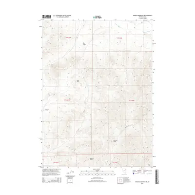
2015 Map of Ninemile Mountain NE
USGS Topo · Published 2015About this map
Thousand Springs Creek cuts across the northern reaches of this high-altitude landscape in northeastern Elko County, marking a vital water source in an otherwise arid expanse. The topography is defined by the northern edges of the Leach Range and a series of deep cuts including Twelvemile Canyon and Wildhorse Canyon in the south. Unlike many lower-elevation basins, the terrain here is heavily dissected, as seen in the drainage of Twentymone Mile Draw and the prominence of Rocky Butte. The presence of CR-765 provides the primary access route through this territory, which is divided by the Public Land Survey System into townships such as t41n r68e. This area's geography is characterized by steep elevation changes and isolated canyons like Coin Canyon, reflecting the traditional open-range character of the Nevada interior.
Find a feature on this map
16 named features on this map. Tap any name to fly to it.
Don’t see what you’re looking for? This feature index may not catch every label — zoom into the map to look around manually.
Map Details
Editions of this 2015 Ninemile Mountain NE Map
This is the sole edition of this map. No revisions or reprints were ever made.
Other maps of this area

1955 · Wells
USGS Topo · 1:250,000

1958 · Wells
USGS Topo · 1:250,000

1961 · Wells
USGS Topo · 1:250,000

1961 · Delano Mountains
USGS Topo · 1:62,500

1961 · Dairy Valley
USGS Topo · 1:62,500

1967 · Montello Canyon
USGS Topo · 1:24,000

1967 · Twelvemile Ranch
USGS Topo · 1:24,000

1967 · Montello
USGS Topo · 1:24,000

1967 · Ninemile Mtn NE
USGS Topo · 1:24,000

1967 · Ninemile Mtn SW
USGS Topo · 1:24,000