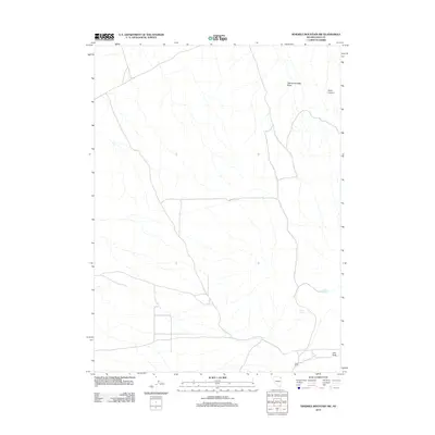
2012 Map of Ninemile Mountain SW
USGS Topo · Published 2012About this map
Leach Ranch sits in the southern portion of this high-desert Elko County landscape, serving as a primary human landmark in a region dominated by ephemeral drainage systems and topographic passes. The drainage of Twentyone Mile Draw carves through the northern terrain, while Kane Canyon and the crossing at Ives Pass illustrate the natural corridors used for movement through the Great Basin. This 2012 survey by the U.S. Geological Survey documents a land shaped by scarce water sources, as evidenced by the mapping of North Spring and Lewis Spring. The grid of local roads and 4WD tracks suggests a landscape managed for ranching and resource access, typical of the high-elevation basins of northeastern Nevada during the early 21st century.
Find a feature on this map
6 named features on this map. Tap any name to fly to it.
Don’t see what you’re looking for? This feature index may not catch every label — zoom into the map to look around manually.
Map Details
Editions of this 2012 Ninemile Mountain SW Map
This is the sole edition of this map. No revisions or reprints were ever made.
Other maps of this area

1955 · Wells
USGS Topo · 1:250,000

1958 · Wells
USGS Topo · 1:250,000

1961 · Wells
USGS Topo · 1:250,000

1967 · Valley Pass
USGS Topo · 1:24,000

1967 · Loray
USGS Topo · 1:24,000

1967 · Montello Canyon
USGS Topo · 1:24,000

1967 · Ninemile Mtn NE
USGS Topo · 1:24,000

1967 · Ninemile Mtn SW
USGS Topo · 1:24,000

1967 · Ninemile Mtn
USGS Topo · 1:24,000

1968 · Pequop
USGS Topo · 1:24,000