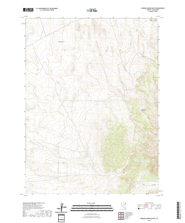
2021 Map of Ninemile Mountain SW
USGS Topo · Published 2021About this map
Leach Range terrain dominates the northeastern portion of this quadrangle in Elko County, where high ridges overlook a complex system of seasonal drainages. These arid landscapes are defined by deep cuts such as Fivemile Draw and Twentyone Mile Draw, which reveal the natural erosion patterns of the Great Basin. The presence of North Spring and Kane Canyon highlights the critical, though sparse, water sources that have historically dictated movement and land use in this corner of Nevada. Toward the south, Ives Pass serves as a notable topographic landmark, situated between high-elevation contours that reach above 7,000 feet. This 2021 survey illustrates a largely undeveloped expanse, primarily organized by the Public Land Survey System grids of t40n r67e and t39n r67e.
Find a feature on this map
10 named features on this map. Tap any name to fly to it.
Don’t see what you’re looking for? This feature index may not catch every label — zoom into the map to look around manually.
Map Details
Editions of this 2021 Ninemile Mountain SW Map
This is the sole edition of this map. No revisions or reprints were ever made.
Other maps of this area

1955 · Wells
USGS Topo · 1:250,000

1958 · Wells
USGS Topo · 1:250,000

1961 · Wells
USGS Topo · 1:250,000

1967 · Valley Pass
USGS Topo · 1:24,000

1967 · Loray
USGS Topo · 1:24,000

1967 · Montello Canyon
USGS Topo · 1:24,000

1967 · Ninemile Mtn NE
USGS Topo · 1:24,000

1967 · Ninemile Mtn SW
USGS Topo · 1:24,000

1967 · Ninemile Mtn
USGS Topo · 1:24,000

1968 · Pequop
USGS Topo · 1:24,000