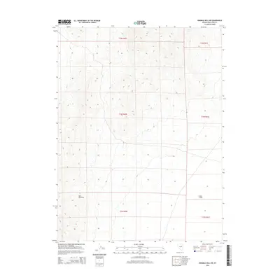
2014 Map of Ninemile Well NW
USGS Topo · Published 2014About this map
Butte Mountains and the expansive Butte Valley dominate this High Desert landscape in eastern Nevada. This topographic study captures a territory defined by stark elevation changes and critical water sources in an otherwise arid environment. The presence of Willow Spring in the northern reaches and Pony Springs further south indicates the traditional reliance on specific water points for survival and transit through the basin-and-range terrain. The map meticulously documents the Public Land Survey System grid, including townships t25n r60e, t24n r60e, and t23n r60e, providing a precise framework for understanding land use and cattle grazing patterns in White Pine County during the early 21st century.
Find a feature on this map
10 named features on this map. Tap any name to fly to it.
Don’t see what you’re looking for? This feature index may not catch every label — zoom into the map to look around manually.
Map Details
Editions of this 2014 Ninemile Well NW Map
This is the sole edition of this map. No revisions or reprints were ever made.
Other maps of this area

1955 · Elko
USGS Topo · 1:250,000

1956 · Ely
USGS Topo · 1:250,000

1958 · Elko
USGS Topo · 1:250,000

1959 · Ely
USGS Topo · 1:250,000

1962 · Elko
USGS Topo · 1:250,000

1963 · Ely
USGS Topo · 1:250,000

1965 · Elko
USGS Topo · 1:250,000
1968 · Ruby Lake SE
USGS Topo · 1:24,000

1982 · Ninemile Well
USGS Topo · 1:24,000
1982 · Junction Well
USGS Topo · 1:24,000