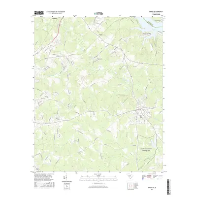
2017 Map of Ninety Six
USGS Topo · Published 2017About this map
The Ninety Six National Historic Site preserves the legacy of the Colonial and Revolutionary War era, including the star-shaped earthworks at Star Fort Pond. Located in Greenwood County, the town of Ninety Six sits at the junction of several regional routes, surrounded by a landscape defined by creeks such as Wilson Creek and Marion Cr. The town's layout reflects its development as a local hub, with residential growth extending toward areas like Pinehurst.
Find a feature on this map
119 named features on this map. Tap any name to fly to it.
Don’t see what you’re looking for? This feature index may not catch every label — zoom into the map to look around manually.
Map Details
Editions of this 2017 Ninety Six Map
This is the sole edition of this map. No revisions or reprints were ever made.
Other maps of this area

1892 · Abbeville
USGS Topo · 1:125,000

1908 · Kirksey
USGS Topo · 1:24,000

1941 · Spartanburg
USGS Topo · 1:250,000

1949 · Ninety-Six
USGS Topo · 1:24,000

1949 · Greenwood
USGS Topo · 1:24,000

1950 · Bradley
USGS Topo · 1:24,000

1950 · Kirksey
USGS Topo · 1:24,000

1953 · Spartanburg
USGS Topo · 1:250,000

1954 · Greenville
USGS Topo · 1:250,000

1958 · Greenville
USGS Topo · 1:250,000