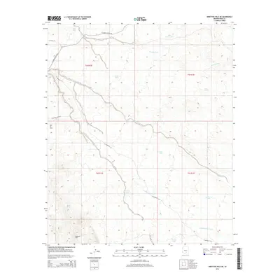
2014 Map of Ninetysix Hills NE
USGS Topo · Published 2014About this map
Ninetysix Hills and the neighboring Box O Hills define this arid landscape in Pinal County, where a network of ephemeral drainage systems carves through the desert floor. The map highlights the vital role of water management in this environment, featuring numerous scattered reservoirs and catchment points such as The Lake Tank, Beehive Tank, and Middle Tank. These features represent essential infrastructure for ranching operations in a region dominated by seasonal watercourses like Cottonwood Wash and Donnelly Wash.
Find a feature on this map
22 named features on this map. Tap any name to fly to it.
Don’t see what you’re looking for? This feature index may not catch every label — zoom into the map to look around manually.
Map Details
Editions of this 2014 Ninetysix Hills NE Map
This is the sole edition of this map. No revisions or reprints were ever made.
Other maps of this area

1900 · Florence
USGS Topo · 1:125,000

1902 · Florence
USGS Topo · 1:125,000

1910 · Ray
USGS Topo · 1:62,500

1911 · Winkelman
USGS Topo · 1:125,000

1913 · Winkelman
USGS Topo · 1:125,000

1934 · Newman Peak
USGS Topo · 1:125,000

1949 · Crozier Peak
USGS Topo · 1:24,000

1949 · Winkelman
USGS Topo · 1:62,500

1949 · Black Mountain
USGS Topo · 1:24,000
1950 · Crozier Peak
USGS Topo · 1:24,000