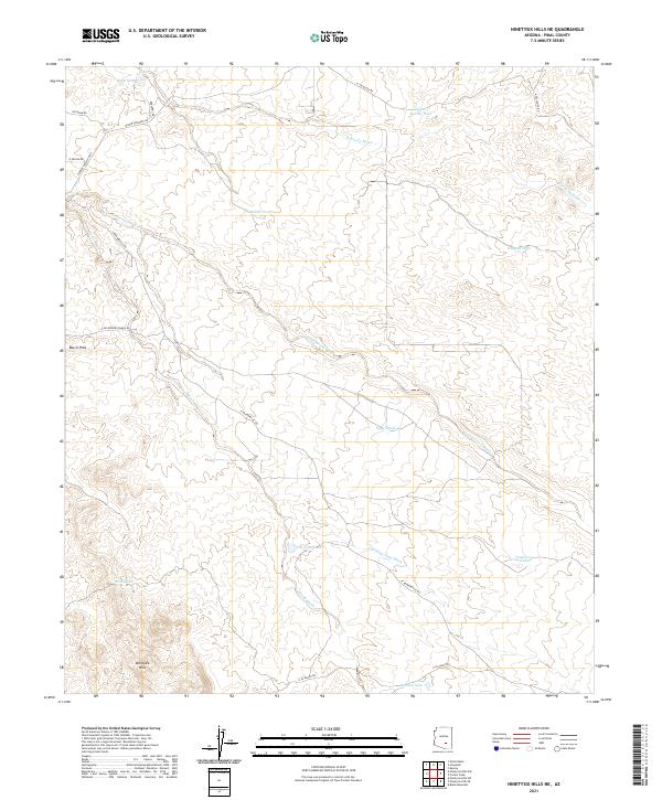
2021 Map of Ninetysix Hills NE
USGS Topo · Published 2021About this map
Ninetysix Hills and the Box O Hills define this arid landscape in Pinal County, where seasonal drainage and cattle ranching infrastructure dictate the layout of the land. The topography is etched by numerous dry washes, including Cottonwood Wash, Donnelly Wash, and Lambing Camp Wash, which serve as the primary geographical markers in an area otherwise characterized by desert scrub and rolling elevations.
Find a feature on this map
27 named features on this map. Tap any name to fly to it.
Don’t see what you’re looking for? This feature index may not catch every label — zoom into the map to look around manually.
Map Details
Editions of this 2021 Ninetysix Hills NE Map
This is the sole edition of this map. No revisions or reprints were ever made.
Other maps of this area

1900 · Florence
USGS Topo · 1:125,000

1902 · Florence
USGS Topo · 1:125,000

1910 · Ray
USGS Topo · 1:62,500

1911 · Winkelman
USGS Topo · 1:125,000

1913 · Winkelman
USGS Topo · 1:125,000

1934 · Newman Peak
USGS Topo · 1:125,000

1949 · Crozier Peak
USGS Topo · 1:24,000

1949 · Winkelman
USGS Topo · 1:62,500

1949 · Black Mountain
USGS Topo · 1:24,000
1950 · Crozier Peak
USGS Topo · 1:24,000