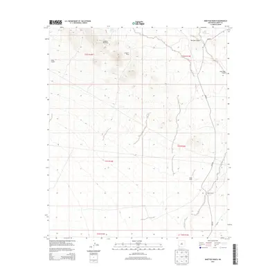
2013 Map of Ninetysix Ranch
USGS Topo · Published 2013About this map
Ninetysix Ranch stands as the primary namesake landmark in this corner of Grant County, where the high desert terrain is defined by dramatic elevation changes and essential water management. The Langford Mountains dominate the northern landscape, shedding runoff into a complex system of drainage features including Langford Draw and New Well Canyon. To support cattle operations and survival in this arid environment, a series of catchment features are distributed across the territory, such as Glaze Tank, Dons Tank, and Rincon Tank. These tanks and draws reveal the traditional ranching infrastructure required to sustain life in the Chihuahuan Desert. The eastern edge is traced by Ninetysix Creek, while the presence of Separ Rd and Gage Rd provides the modern corridor through this historically isolated section of New Mexico.
Find a feature on this map
19 named features on this map. Tap any name to fly to it.
Don’t see what you’re looking for? This feature index may not catch every label — zoom into the map to look around manually.
Map Details
Editions of this 2013 Ninetysix Ranch Map
This is the sole edition of this map. No revisions or reprints were ever made.
Other maps of this area

1954 · Silver City
USGS Topo · 1:250,000

1958 · Silver City
USGS Topo · 1:250,000

1962 · Silver City
USGS Topo · 1:250,000

1962 · Ninetysix Ranch
USGS Topo · 1:24,000

1962 · Lisbon
USGS Topo · 1:24,000

1963 · Gold Hill
USGS Topo · 1:24,000

1963 · Soldiers Farewell Hill
USGS Topo · 1:24,000
1963 · Werney Hill
USGS Topo · 1:24,000
1963 · C Bar Ranch
USGS Topo · 1:24,000

1964 · Muir Ranch
USGS Topo · 1:24,000