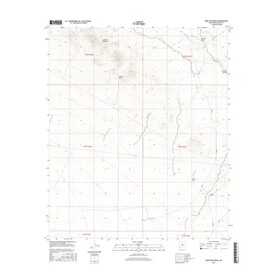
2017 Map of Ninetysix Ranch
USGS Topo · Published 2017About this map
Ninetysix Ranch serves as a primary landmark in this corner of southwestern New Mexico, situated near the seasonal waters of Ninetysix Creek. The landscape is dominated by the Langford Mountains in the north, giving way to a series of drainage basins including Langford Draw and Smith Draw. This area of Grant County is characterized by ranching infrastructure and water management features essential for the arid environment, such as Glaze Tank, Bons Tank, and Rincon Tank. A network of unpaved desert routes, including Separ Rd and Jones Ranch Rd, provides the only connection between these distant outposts. The topographic detail reveals the complex network of dry canyons, most notably New Well Canyon and South Well Canyon, illustrating the rugged drainage patterns that define the region south of the Continental Divide.
Find a feature on this map
24 named features on this map. Tap any name to fly to it.
Don’t see what you’re looking for? This feature index may not catch every label — zoom into the map to look around manually.
Map Details
Editions of this 2017 Ninetysix Ranch Map
This is the sole edition of this map. No revisions or reprints were ever made.
Other maps of this area

1954 · Silver City
USGS Topo · 1:250,000

1958 · Silver City
USGS Topo · 1:250,000

1962 · Silver City
USGS Topo · 1:250,000

1962 · Ninetysix Ranch
USGS Topo · 1:24,000

1962 · Lisbon
USGS Topo · 1:24,000

1963 · Gold Hill
USGS Topo · 1:24,000

1963 · Soldiers Farewell Hill
USGS Topo · 1:24,000
1963 · Werney Hill
USGS Topo · 1:24,000
1963 · C Bar Ranch
USGS Topo · 1:24,000

1964 · Muir Ranch
USGS Topo · 1:24,000