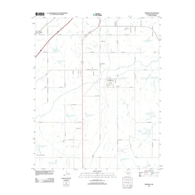
2012 Map of Ninnekah
USGS Topo · Published 2012About this map
Ninnekah and the smaller community of Norge define the settlement patterns of this central Oklahoma landscape. The area is heavily defined by the winding course of the Little Washita River and a sophisticated network of water management sites, including Little Washita Site 6 Reservoir and Little Washita Site 1 Reservoir. This complex drainage system supports the agricultural plains between Hog Cr and Rock Cr. Genealogy interests are well-served by the presence of Ninnekah Cem and the Moncrief Cem, located north of the river. The map also features transportation landmarks such as Neil's Sky Ranch Airport and the local Post Office in the heart of Ninnekah, showing the town's role as a local hub for the surrounding rural sections.
Find a feature on this map
90 named features on this map. Tap any name to fly to it.
Don’t see what you’re looking for? This feature index may not catch every label — zoom into the map to look around manually.
Map Details
Editions of this 2012 Ninnekah Map
This is the sole edition of this map. No revisions or reprints were ever made.
Other maps of this area

1902 · Rush Springs
USGS Topo · 1:125,000

1904 · Chickasha
USGS Topo · 1:125,000

1945 · Anadarko
USGS Topo · 1:62,500

1949 · Cement
USGS Topo · 1:62,500

1949 · Rush Springs
USGS Topo · 1:62,500

1950 · Rush Springs
USGS Topo · 1:62,500

1954 · Oklahoma City
USGS Topo · 1:250,000

1955 · Lawton
USGS Topo · 1:250,000

1955 · Clinton
USGS Topo · 1:250,000

1956 · Laverty
USGS Topo · 1:24,000