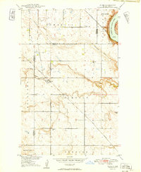
1949 Map of Niobe
USGS Topo · Published 1949About this map
The railroad junction at Niobe serves as a focal point for this late 1940s landscape on the boundary of Burke and Ward Counties. The settlement sits at the confluence of the Great Northern and the Minneapolis St Paul and Sault Ste Marie rail lines, which cut through a terrain defined by deep glacial drainage channels like Ankenbauer Coulee and Niobe Coulee. This survey provides a detailed look at the rural social infrastructure of the era, marking the precise locations of local schools such as Ellendale Sch, Elmdale Sch, and Spencer Sch, alongside the Bethane Cem and Niobe Cem. To the northeast, the Des Lacs National Wildlife Refuge borders the waters of Upper Des Lacs Lake, showing the early conservation efforts in the Missouri River Basin project area.
Find a feature on this map
19 named features on this map. Tap any name to fly to it.
Don’t see what you’re looking for? This feature index may not catch every label — zoom into the map to look around manually.
Map Details
Editions of this 1949 Niobe Map
2 editions found
Other maps of this area

1947 · Bowbells
USGS Topo · 1:24,000

1948 · Kenmare
USGS Topo · 1:24,000

1948 · Coteau
USGS Topo · 1:24,000

1948 · Vanville NE
USGS Topo · 1:24,000

1949 · Mosquito Butte
USGS Topo · 1:24,000

1949 · Bowbells
USGS Topo · 1:24,000

1949 · Bowbells SE
USGS Topo · 1:24,000

1949 · Niobe
USGS Topo · 1:24,000

1949 · Coulee
USGS Topo · 1:24,000

1950 · Vanville NE
USGS Topo · 1:24,000