Loading...
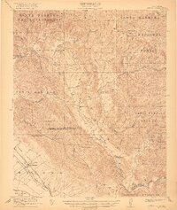
Loading map...1922 Map of Nipomo
USGS Topo · Published 1922About this map
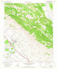
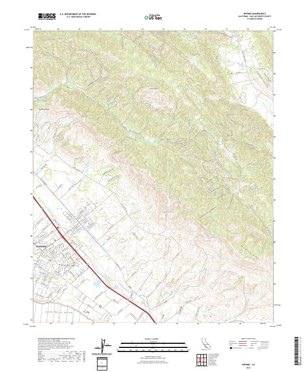
The Nipomo area at the edge of the Santa Barbara National Forest reveals a landscape defined by ranching and rural education just after the First World War. Local life centered on family holdings like Adams Ranch and Porter Ranch, supported by a network of one-room schoolhouses including the Huasna School and Suey Creek School. The transport corridor in the southwest corner is particularly active, showing the Pacific Coast Highway and the Pacific Coast Ry running parallel through the Nipomo Valley.
Find a feature on this map
45 named features on this map. Tap any name to fly to it.
Don’t see what you’re looking for? This feature index may not catch every label — zoom into the map to look around manually.
Map Details
Date Portrayed1922
Date Published1922
PublisherU.S. Geological Survey
Map TypeTopographic
Scale1:62,500
Physical Dimensions16.59 x 19.64 inches
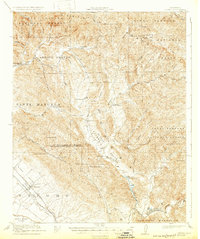
Editions of this 1922 Nipomo Map
4 editions found

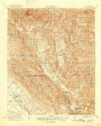
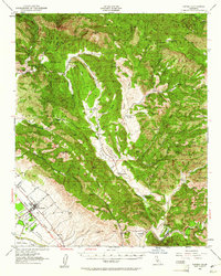
Historical Maps of Huasna Through Time
7 maps found
Featured Locations
Source Details
SourceU.S. Geological Survey
CopyrightPublic Domain