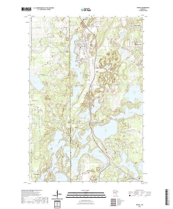
2022 Map of Nisswa
USGS Topo · Published 2022About this map
Pequot Lakes and Nisswa anchor this lake-dense portion of Crow Wing County, where the transition between Cass Co and Crow Wing Co is defined by an intricate network of glacial basins. The landscape is dominated by interconnected water bodies including the northern reaches of Gull Lake and the Upper Cullen Lake, Middle Cullen Lake, and Lower Cullen Lake chain. This modern survey illustrates the residential expansion around these shores, from the established streets of Breezy Point to the developments surrounding Lake Shore.
Find a feature on this map
153 named features on this map. Tap any name to fly to it.
Don’t see what you’re looking for? This feature index may not catch every label — zoom into the map to look around manually.
Map Details
Editions of this 2022 Nisswa Map
This is the sole edition of this map. No revisions or reprints were ever made.
Other maps of this area

1915 · Brainerd
USGS Topo · 1:62,500

1916 · Pillager
USGS Topo · 1:62,500

1918 · Brainerd
USGS Topo · 1:62,500

1919 · Pillager
USGS Topo · 1:62,500

1953 · Brainerd
USGS Topo · 1:250,000

1957 · Brainerd
USGS Topo · 1:250,000

1958 · Brainerd
USGS Topo · 1:250,000

1959 · Pelican Lake
USGS Topo · 1:24,000

1959 · Nisswa
USGS Topo · 1:24,000

1959 · Lower Whitefish Lake
USGS Topo · 1:24,000