
1959 Map of Lower Whitefish Lake
USGS Topo · Published 1960About this map
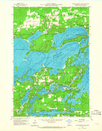
Lower Whitefish Lake and Upper Whitefish Lake anchor a landscape defined by an intricate network of water and woods in the late 1950s. This survey, compiled from 1957 aerial photography, reveals a region transitioning between wilderness and recreation, with Crow Wing State Forest and Timothy preserving large tracts of timber. Small lakeside communities such as Manhattan Beach and Swanburg dot the northern shorelines, while the southern reaches center on Cross Lake Village. The map documents numerous smaller water bodies with evocative local names, including Pecks Puddle, Hooligans Hole, and Dewdrop Lake. Local genealogy and community history are grounded in specific sites like the Swanburg Cem and Our Lady of the Snows Chapel, which stands overlooking the southern edge of the Big Trout Lake channel. Further south, the map details the area around Pelican Lakes Village and the intersection at Ideal Corners.
Find a feature on this map
50 named features on this map. Tap any name to fly to it.
Don’t see what you’re looking for? This feature index may not catch every label — zoom into the map to look around manually.
Map Details
Editions of this 1959 Lower Whitefish Lake Map
3 editions found
Other maps of this area

1953 · Brainerd
USGS Topo · 1:250,000

1957 · Brainerd
USGS Topo · 1:250,000

1958 · Brainerd
USGS Topo · 1:250,000

1959 · Trommald
USGS Topo · 1:24,000

1959 · Pelican Lake
USGS Topo · 1:24,000

1959 · Nisswa
USGS Topo · 1:24,000

1959 · Jenkins
USGS Topo · 1:24,000

1960 · Cross Lake
USGS Topo · 1:24,000

1965 · Brainerd
USGS Topo · 1:250,000
1970 · Mitchell Lake
USGS Topo · 1:24,000
Featured Places
- Breezy Point, MN
- Fifty Lakes, MN
- Manhattan Beach, MN
- Golden Harbor Mobile Home Park, MN
- Sunset Bay Trailer Park, MN