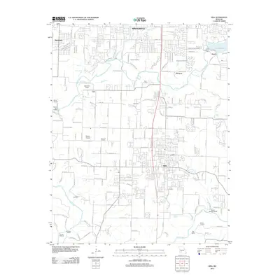
2011 Map of Nixa
USGS Topo · Published 2011About this map
The James River snakes through this 2011 Missouri survey, carving a path from Lake Springfield in the northeast down toward the southwestern reaches of the quadrangle. The city of Nixa serves as the central hub of development, while smaller settlements like Battlefield, Kissick, and Riverpark define the surrounding landscape. The area is marked by numerous family and memorial burial sites, including Patterson Cemetery, McConnell Cemetery, and Bledsoe Memorial Cemetery, providing a wealth of information for local genealogists. Topographically, the region features unique limestone characteristics such as Avin Sink and deep depressions like Turkey Hollow. Infrastructure and recreation are represented by the Lake Springfield Dam, the Nelson Mill Bridge, and the fairways of the Shady Acres Golf Course, illustrating the suburban and natural mix of Greene and Christian counties at the start of the decade.
Find a feature on this map
186 named features on this map. Tap any name to fly to it.
Don’t see what you’re looking for? This feature index may not catch every label — zoom into the map to look around manually.
Map Details
Editions of this 2011 Nixa Map
This is the sole edition of this map. No revisions or reprints were ever made.
Other maps of this area

1884 · Springfield
USGS Topo · 1:125,000

1886 · Springfield
USGS Topo · 1:125,000

1907 · Forsyth
USGS Topo · 1:125,000

1935 · Springfield
USGS Topo · 1:24,000

1936 · Brookline
USGS Topo · 1:24,000

1937 · Galloway
USGS Topo · 1:24,000

1937 · Ozark
USGS Topo · 1:48,000

1943 · Ozark
USGS Topo · 1:62,500

1945 · Harrison
USGS Topo · 1:250,000

1945 · Ozark
USGS Topo · 1:62,500