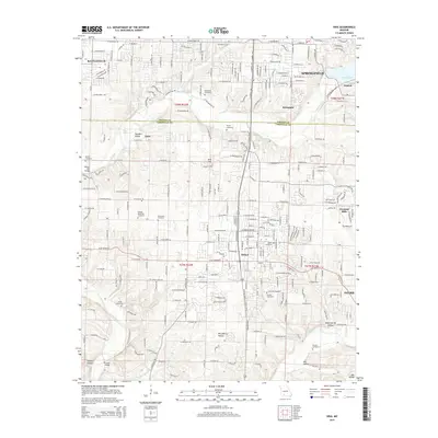
2015 Map of Nixa
USGS Topo · Published 2015About this map
James River and Finley Creek define the geography of this corridor south of Springfield, where suburban expansion meets the longstanding agricultural boundaries of the Greene Co and Christian Co line. The growing municipality of Nixa serves as a central hub, surrounded by smaller communities like Battlefield, Fremont Hills, and Riverpark. This era shows a landscape transitioning through residential development while maintaining deep ties to its rural past, evidenced by numerous family and community burial grounds such as Patterson Cemetery, Payne Cemetery, and Bledsoe Memorial Cemetery. The terrain is marked by distinctive karst features like Avin Sink and the steep contours of Saunders Valley and McCafferty Hollow. Important water sources including Blue Spring, Young Spring, and Wasson Spring are scattered throughout the quadrangle, feeding the river system that eventually reaches Lake Springfield to the northeast.
Find a feature on this map
114 named features on this map. Tap any name to fly to it.
Don’t see what you’re looking for? This feature index may not catch every label — zoom into the map to look around manually.
Map Details
Editions of this 2015 Nixa Map
This is the sole edition of this map. No revisions or reprints were ever made.
Other maps of this area

1884 · Springfield
USGS Topo · 1:125,000

1886 · Springfield
USGS Topo · 1:125,000

1907 · Forsyth
USGS Topo · 1:125,000

1935 · Springfield
USGS Topo · 1:24,000

1936 · Brookline
USGS Topo · 1:24,000

1937 · Galloway
USGS Topo · 1:24,000

1937 · Ozark
USGS Topo · 1:48,000

1943 · Ozark
USGS Topo · 1:62,500

1945 · Harrison
USGS Topo · 1:250,000

1945 · Ozark
USGS Topo · 1:62,500