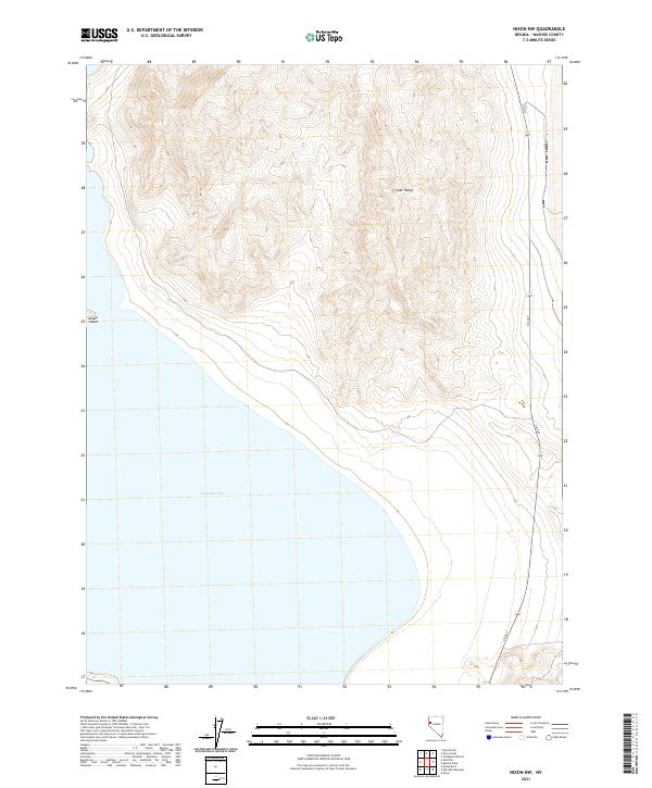
2021 Map of Nixon NW
USGS Topo · Published 2021About this map
Pyramid Lake dominates the southwestern portion of this high-desert landscape, where the water meets the steep eastern slopes of the Lake Range. This 2021 update reveals the dramatic topographic relief between the lake's surface and the ridgelines of the desert mountains. The eastern shore is largely defined by the path of S R 447, which tracks the transition from the high-altitude peaks down toward the water's edge. Off the western shore, the rocky landmass of Anaho Island stands as a prominent landmark within the basin. The map illustrates a primarily uninhabited region of Nevada, defined by its geological formations and the essential transportation corridor that links the remote lake basin to the surrounding territory.
Find a feature on this map
9 named features on this map. Tap any name to fly to it.
Don’t see what you’re looking for? This feature index may not catch every label — zoom into the map to look around manually.
Map Details
Editions of this 2021 Nixon NW Map
This is the sole edition of this map. No revisions or reprints were ever made.
Other maps of this area

1886 · Granite Range
USGS Topo · 1:250,000

1890 · Wadsworth
USGS Topo · 1:125,000

1891 · Reno
USGS Topo · 1:125,000

1892 · Wadsworth
USGS Topo · 1:125,000

1893 · Reno
USGS Topo · 1:125,000

1894 · Granite Range
USGS Topo · 1:250,000

1894 · Wadsworth
USGS Topo · 1:125,000

1955 · Lovelock
USGS Topo · 1:250,000

1957 · Sutcliffe
USGS Topo · 1:62,500

1957 · Nixon
USGS Topo · 1:62,500