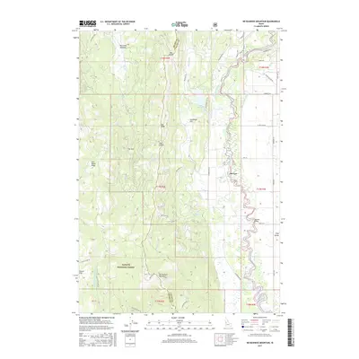
2017 Map of No Business Mountain
USGS Topo · Published 2017About this map
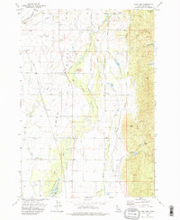
No Business Mountain dominates the western topography of this Idaho region, overlooking the transition from the high ridges of the Payette National Forest to the productive bottomlands of Long Valley. The North Fork Payette River winds along the eastern edge of the quadrangle, where modern infrastructure like the Lake Irrigation District Canal and Hartsell Bridge support the area's water management and transport networks. Evidence of earlier frontier history is preserved in the label for Old Fort, situated near the riverbanks, and Squaw Flat to the southwest. The landscape is a network of named high points and basins, from Blue Bunch Ridge to Big Creek Meadows and Sunflower Flat. Diverse water features including Hait Reservoir and the northern tip of Lake Cascade define the hydrologic character of the Valley and Adams county line area.
Find a feature on this map
51 named features on this map. Tap any name to fly to it.
Don’t see what you’re looking for? This feature index may not catch every label — zoom into the map to look around manually.
Map Details
Editions of this 2017 No Business Mountain Map
This is the sole edition of this map. No revisions or reprints were ever made.
Other maps of this area

1911 · Meadows
USGS Topo · 1:125,000

1954 · Council
USGS Topo · 1:62,500

1954 · New Meadows
USGS Topo · 1:62,500

1954 · Cascade
USGS Topo · 1:62,500

1955 · Baker
USGS Topo · 1:250,000

1959 · Baker
USGS Topo · 1:250,000
1973 · Meadows
USGS Topo · 1:24,000
1973 · No Business Mtn
USGS Topo · 1:24,000
1973 · McCall
USGS Topo · 1:24,000
1973 · Lake Fork
USGS Topo · 1:24,000