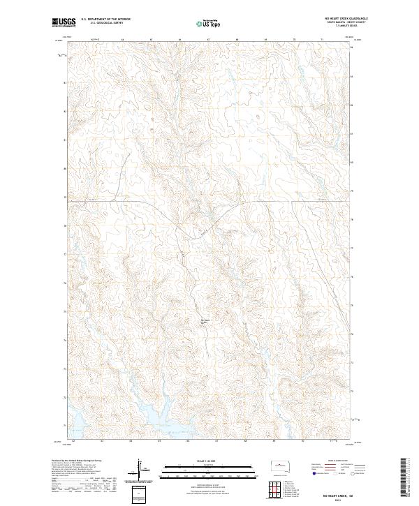
2021 Map of No Heart Creek
USGS Topo · Published 2021About this map
No Heart Butte stands as the central landmark in this portion of Dewey County, overlooking a landscape defined by its complex drainage systems and the expansive waters of Lake Oahe. The map illustrates the rugged topography of the Cheyenne River Reservation, where the Missouri River forms the southern boundary. Numerous named waterways, including No Heart Cr, Tall Prairie Chicken Cr, and Little Willow Cr, carve deep coulees through the high plains. While modern routes like Bia Hwy 8 and Bia Rd 8 provide contemporary access, the map primarily documents the natural landforms and the scale of the reservoir. This detailed survey captures the intersection of the prairie landscape with the hydraulic engineering of the Missouri River, showing the vast reach of the reservoir into the surrounding drainages like Charlie Cr.
Find a feature on this map
15 named features on this map. Tap any name to fly to it.
Don’t see what you’re looking for? This feature index may not catch every label — zoom into the map to look around manually.
Map Details
Editions of this 2021 No Heart Creek Map
This is the sole edition of this map. No revisions or reprints were ever made.
Other maps of this area

1953 · McIntosh
USGS Topo · 1:250,000

1954 · Pierre
USGS Topo · 1:250,000

1958 · Pierre
USGS Topo · 1:250,000

1958 · McIntosh
USGS Topo · 1:250,000

1969 · Rousseau Creek
USGS Topo · 1:24,000

1969 · No Heart Creek SE
USGS Topo · 1:24,000

1969 · No Heart Creek SW
USGS Topo · 1:24,000

1981 · Charlie Creek
USGS Topo · 1:24,000
1981 · No Heart Creek NE
USGS Topo · 1:24,000
1981 · Stove Creek
USGS Topo · 1:24,000