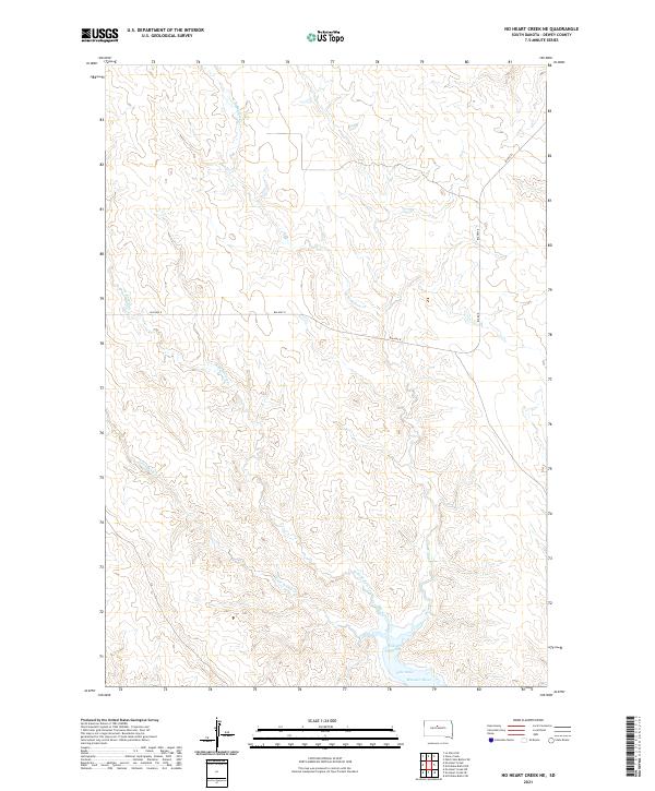
2021 Map of No Heart Creek NE
USGS Topo · Published 2021About this map
Lake Oahe and the Missouri River dominate the southern landscape of this Dewey County quadrangle, where the massive reservoir meets the rolling prairie. The topography is defined by the intricate drainages of Willow Creek, including the Little Willow Cr, W Br Willow Cr, and E Br Willow Cr. These seasonal waterways carve deep through the terrain, eventually converging at Willow Creek Bay. Transport through this sparsely populated region is facilitated by the Bia Hwy 8 and Bia Rd 8 corridors, which navigate the high ground between the draws. The map illustrates the contemporary intersection of tribal infrastructure and the vast Missouri River water system, providing a clear view of the shoreline and elevation changes across townships t12n r29e and t11n r30e.
Find a feature on this map
12 named features on this map. Tap any name to fly to it.
Don’t see what you’re looking for? This feature index may not catch every label — zoom into the map to look around manually.
Map Details
Editions of this 2021 No Heart Creek NE Map
This is the sole edition of this map. No revisions or reprints were ever made.
Other maps of this area

1953 · McIntosh
USGS Topo · 1:250,000

1954 · Pierre
USGS Topo · 1:250,000

1958 · Pierre
USGS Topo · 1:250,000

1958 · McIntosh
USGS Topo · 1:250,000

1965 · Artichoke Butte SW
USGS Topo · 1:24,000

1969 · No Heart Creek SE
USGS Topo · 1:24,000

1969 · Artichoke Butte NW
USGS Topo · 1:24,000

1969 · Patch Skin Buttes SW
USGS Topo · 1:24,000

1969 · No Heart Creek SW
USGS Topo · 1:24,000
1981 · No Heart Creek NE
USGS Topo · 1:24,000