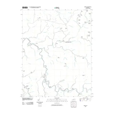
2010 Map of Noble
USGS Topo · Published 2010About this map
Troublesome Creek and its many winding tributaries, including Buckhorn Creek and Long Fork, form the backbone of this Breathitt County landscape. The settlement of Noble sits at a central junction of these waterways, while smaller community centers are marked by the Rowdy Post Office and Ary Post Office. The map reveals a dense concentration of family and community burial grounds, such as the Napier Cemeteries, Hays Cemetery, and Noble Cemeteries, which are essential for genealogical research in this part of Kentucky.
Find a feature on this map
109 named features on this map. Tap any name to fly to it.
Don’t see what you’re looking for? This feature index may not catch every label — zoom into the map to look around manually.
Map Details
Editions of this 2010 Noble Map
This is the sole edition of this map. No revisions or reprints were ever made.
Other maps of this area

1889 · Salyersville
USGS Topo · 1:125,000

1891 · Hazard
USGS Topo · 1:125,000

1891 · Salyersville
USGS Topo · 1:125,000

1899 · Salyersville
USGS Topo · 1:125,000

1913 · Buckhorn
USGS Topo · 1:62,500

1914 · Troublesome
USGS Topo · 1:62,500

1951 · Tiptop
USGS Topo · 1:24,000

1951 · Guage
USGS Topo · 1:24,000

1951 · Quicksand
USGS Topo · 1:24,000

1954 · Noble
USGS Topo · 1:24,000