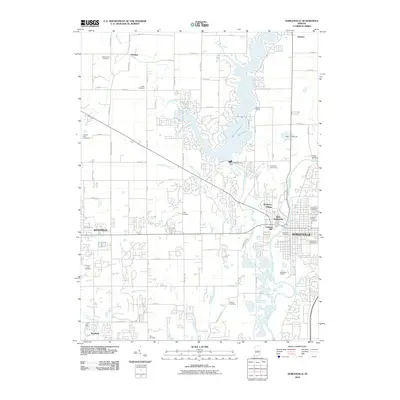
2010 Map of Noblesville
USGS Topo · Published 2010About this map
Noblesville and Westfield anchor this suburbanizing landscape in central Indiana, where the White River and Morse Reservoir define the local geography. The map documents a significant number of family and community burial grounds, including the Hinkle Cemetery, Thorp Cemetery, and Gascho-Trissel Cemetery, which serve as vital touchstones for genealogical research in Hamilton County. The expansion of residential neighborhoods is evident around Morse Marina and Monterey Village, contrasting with the more rural northern reaches near Deming and Fox Prairie. Notable infrastructure such as the Morse Reservoir Dam and the Potter Bridge cross-section the waterways of Cicero Creek and Hinkle Creek, illustrating how the region's historical reliance on rivers has transitioned into modern recreation and water management.
Find a feature on this map
79 named features on this map. Tap any name to fly to it.
Don’t see what you’re looking for? This feature index may not catch every label — zoom into the map to look around manually.
Map Details
Editions of this 2010 Noblesville Map
This is the sole edition of this map. No revisions or reprints were ever made.
Other maps of this area

1952 · Fishers
USGS Topo · 1:24,000

1952 · Carmel
USGS Topo · 1:24,000

1952 · Mc Cordsville
USGS Topo · 1:24,000

1953 · Westfield
USGS Topo · 1:24,000

1953 · Riverwood
USGS Topo · 1:24,000

1953 · Noblesville
USGS Topo · 1:24,000

1953 · Cincinnati
USGS Topo · 1:250,000

1953 · Danville
USGS Topo · 1:250,000

1953 · Indianapolis
USGS Topo · 1:250,000

1953 · Muncie
USGS Topo · 1:250,000