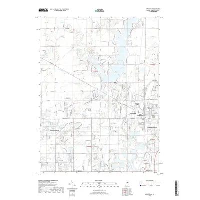
2019 Map of Noblesville
USGS Topo · Published 2019About this map
Morse Reservoir dominates the northern half of this Hamilton County landscape, where the waters of Cicero Creek and Hinkle Creek are impounded. To the south, the suburban expansion of Noblesville, Westfield, and northern Carmel is evident in a dense network of residential streets and numbered thoroughfares like E 146th St. Despite the modern development, numerous historical markers remain, particularly in the form of small family and community burial grounds such as Tharp Mott Cem and West Grove Cem. The White River winds through the southeastern portion of the quadrangle near Fishers, passing beneath Potter Bridge. This 2019 survey documents a region in transition, where legacy agricultural boundaries of t19n r4e meet the modern infrastructure of Mc Gill Airport and growing neighborhoods like Monterey Village.
Find a feature on this map
63 named features on this map. Tap any name to fly to it.
Don’t see what you’re looking for? This feature index may not catch every label — zoom into the map to look around manually.
Map Details
Editions of this 2019 Noblesville Map
This is the sole edition of this map. No revisions or reprints were ever made.
Other maps of this area

1952 · Fishers
USGS Topo · 1:24,000

1952 · Carmel
USGS Topo · 1:24,000

1952 · Mc Cordsville
USGS Topo · 1:24,000

1953 · Westfield
USGS Topo · 1:24,000

1953 · Riverwood
USGS Topo · 1:24,000

1953 · Noblesville
USGS Topo · 1:24,000

1953 · Cincinnati
USGS Topo · 1:250,000

1953 · Danville
USGS Topo · 1:250,000

1953 · Indianapolis
USGS Topo · 1:250,000

1953 · Muncie
USGS Topo · 1:250,000