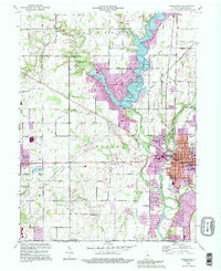
1992 Map of Noblesville
USGS Topo · Published 1995About this map
The White River and the expansive Morse Reservoir dominate this Hamilton County landscape, where suburban expansion meets long-standing agricultural roots. This survey captures Noblesville during a period of transition, showing the city's traditional core around the Courthouse and City Hall alongside newer developments like Monterey Village. The rural reaches are dotted with historical markers of community life, including the West Grove Ch and its adjacent West Grove Cem, as well as the Gray Friends Ch to the south. Notable infrastructure like the Potter Bridge and a network of pipelines crossing the Railroad Grade illustrate the region's evolving transportation and utility needs. From the educational hub of the High Sch and Jr High Sch to the recreational Indianapolis Boys Club Camp, the map documents a community balancing its river-valley heritage with late-twentieth-century growth.
Find a feature on this map
78 named features on this map. Tap any name to fly to it.
Don’t see what you’re looking for? This feature index may not catch every label — zoom into the map to look around manually.
Map Details
Editions of this 1992 Noblesville Map
This is the sole edition of this map. No revisions or reprints were ever made.
Other maps of this area

1952 · Fishers
USGS Topo · 1:24,000

1952 · Carmel
USGS Topo · 1:24,000

1952 · Mc Cordsville
USGS Topo · 1:24,000

1953 · Westfield
USGS Topo · 1:24,000

1953 · Riverwood
USGS Topo · 1:24,000

1953 · Noblesville
USGS Topo · 1:24,000

1953 · Cincinnati
USGS Topo · 1:250,000

1953 · Danville
USGS Topo · 1:250,000

1953 · Indianapolis
USGS Topo · 1:250,000

1953 · Muncie
USGS Topo · 1:250,000