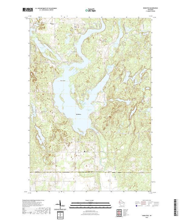
2022 Map of Nobleton
USGS Topo · Published 2022About this map
The glacial waters of Long Lake dominate this Washburn County landscape, creating a complex shoreline that includes Gruenhagen Bay and prominent landmarks like Christiana Point. The small settlements of Nobleton and Madge serve as focal points for a region defined by its numerous water bodies, ranging from the sizeable Big Devil Lake to smaller basins like Pollywog Lake and Loon Lake. The presence of an Abandoned RR cutting through the western section suggests a shift in the local economy, moving away from earlier industrial transport towards a layout now defined by lakeside roads and recreational access points.
Find a feature on this map
66 named features on this map. Tap any name to fly to it.
Don’t see what you’re looking for? This feature index may not catch every label — zoom into the map to look around manually.
Map Details
Editions of this 2022 Nobleton Map
This is the sole edition of this map. No revisions or reprints were ever made.
Other maps of this area

1948 · Spooner
USGS Topo · 1:48,000

1948 · Stone Lake
USGS Topo · 1:48,000

1949 · Spooner
USGS Topo · 1:48,000

1949 · Rice Lake
USGS Topo · 1:48,000

1950 · Stone Lake
USGS Topo · 1:48,000

1951 · Shell Lake
USGS Topo · 1:48,000

1951 · Rice Lake
USGS Topo · 1:48,000

1953 · Rice Lake
USGS Topo · 1:250,000

1959 · Rice Lake
USGS Topo · 1:250,000

1965 · Rice Lake
USGS Topo · 1:62,500