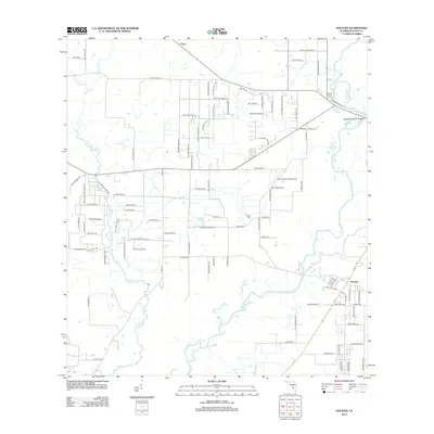
2012 Map of Nocatee
USGS Topo · Published 2012About this map
Peace River and Joshua Cr converge near the town of Nocatee, defining the hydrological character of this DeSoto County landscape. The map illustrates a rural area transition into a grid of residential and agricultural roads, particularly around the settlement of Tryon in the north. This region's history is anchored by long-standing landmarks such as the Owens Cem and Oak Hill Cemetery St, which offer points of interest for genealogists tracing local families. Transportation infrastructure is highlighted by the Chesterfield Smith Bridge crossing the river and the presence of Mc Donald's Field Airport, reflecting the local aviation and transit needs of the early 21st century. The intricate network of creeks, including Horse Cr and Buzzard Roost Br, suggests a landscape shaped by seasonal water flow and drainage patterns typical of the Florida interior.
Find a feature on this map
96 named features on this map. Tap any name to fly to it.
Don’t see what you’re looking for? This feature index may not catch every label — zoom into the map to look around manually.
Map Details
Editions of this 2012 Nocatee Map
This is the sole edition of this map. No revisions or reprints were ever made.
Other maps of this area

1956 · Gardner
USGS Topo · 1:24,000

1956 · Arcadia SE
USGS Topo · 1:24,000

1956 · Edgeville
USGS Topo · 1:24,000

1956 · Murdock SE
USGS Topo · 1:24,000

1956 · Murdock NE
USGS Topo · 1:24,000

1956 · Limestone
USGS Topo · 1:24,000

1956 · Ft. Ogden
USGS Topo · 1:24,000

1956 · Nocatee
USGS Topo · 1:24,000

1956 · Tampa
USGS Topo · 1:250,000

1956 · Fort Pierce
USGS Topo · 1:250,000