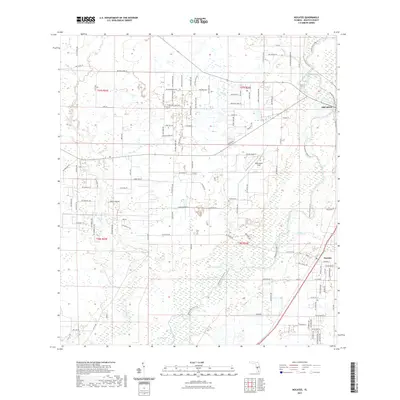
2021 Map of Nocatee
USGS Topo · Published 2021About this map
The Peace River and Horse Creek dominate this DeSoto County landscape, carving through a region defined by extensive wetlands and seasonal lakes. The settlement of Nocatee serves as a local hub near the southern confluence of Joshua Cr, while the outskirts of Arcadia appear in the northeast corner of the sheet. The map reveals a transition from traditional rural landmarks, such as the Owens Cem and Owens School St, to recreational features like the Peace River State Trl. Scattered water bodies including Bee Gum Lake, Johnson Lake, and Grass Lake highlight the low-lying hydrology of the area. This modern survey reflects the persistent character of Florida's interior, where small communities remain anchored to the river systems and local aviation is represented by McDonald's Field.
Find a feature on this map
117 named features on this map. Tap any name to fly to it.
Don’t see what you’re looking for? This feature index may not catch every label — zoom into the map to look around manually.
Map Details
Editions of this 2021 Nocatee Map
This is the sole edition of this map. No revisions or reprints were ever made.
Other maps of this area

1956 · Gardner
USGS Topo · 1:24,000

1956 · Arcadia SE
USGS Topo · 1:24,000

1956 · Edgeville
USGS Topo · 1:24,000

1956 · Murdock SE
USGS Topo · 1:24,000

1956 · Murdock NE
USGS Topo · 1:24,000

1956 · Limestone
USGS Topo · 1:24,000

1956 · Ft. Ogden
USGS Topo · 1:24,000

1956 · Nocatee
USGS Topo · 1:24,000

1956 · Tampa
USGS Topo · 1:250,000

1956 · Fort Pierce
USGS Topo · 1:250,000