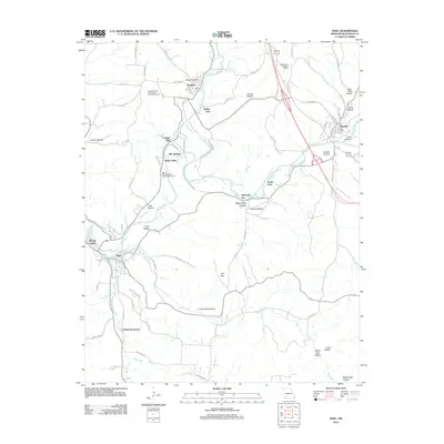
2012 Map of Noel
USGS Topo · Published 2012About this map
Elk River and Indian Creek converge in this corner of southwest Missouri, shaping a landscape of deep hollows and narrow ridges. The 2012 survey illustrates the modern layout of the river valley settlements, where the resort-heavy geography of Ginger Blue, Elk Springs, and Mount Shira lines the riverbanks south of Lanagan. This area is defined by its recreational and natural resources, featuring the Lanagan Tower State Public Hunting Grounds and the Mount Shira Elk River Public Access Area. Further east, the county seat of Pineville sits along the Big Sugar Creek, while to the south, industrial activity is marked by the Armstrong Quarry. The topography is a maze of named drainage points like Rattlesnake Hollow, Crane Nest Hollow, and Crazy Hollow, providing a clear look at the complex drainage system feeding into Mill Creek and Deer Creek before they reach the main river channel.
Find a feature on this map
74 named features on this map. Tap any name to fly to it.
Don’t see what you’re looking for? This feature index may not catch every label — zoom into the map to look around manually.
Map Details
Editions of this 2012 Noel Map
This is the sole edition of this map. No revisions or reprints were ever made.
Other maps of this area

1899 · Fayetteville
USGS Topo · 1:125,000

1899 · Siloam Springs
USGS Topo · 1:125,000

1901 · Fayetteville
USGS Topo · 1:125,000

1903 · Siloam Springs
USGS Topo · 1:125,000

1904 · Siloam Springs
USGS Topo · 1:125,000

1904 · Fayetteville
USGS Topo · 1:125,000

1907 · Wyandotte
USGS Topo · 1:125,000

1909 · Wyandotte
USGS Topo · 1:125,000

1940 · Noel
USGS Topo · 1:62,500

1943 · Noel
USGS Topo · 1:62,500