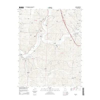
2015 Map of Noel
USGS Topo · Published 2015About this map
The Elk River winds through the Ozark plateau of McDonald County, anchoring a landscape where river tourism and industrial extraction meet. This 2015 survey details the corridor between Anderson and Noel, showing how the Kansas City Southern Ry follows the river valley to serve the region's small settlements. Near the southern bend of the river, Shadow Lake and Spring Valley mark a transition toward the community of Noel, while further north, unique place names like Ginger Blue and Bosky Dell reflect the area's local identity. The terrain is deeply dissected by numerous hollows, such as Honey Lake Hollow and Crane Nest Hollow, which channel drainage into Indian Creek and Butler Creek. Evidence of the local economy is visible at the Armstrong Quarry, while recreation and natural features are represented by the Riverside Inn and Deer Lick Spring.
Find a feature on this map
121 named features on this map. Tap any name to fly to it.
Don’t see what you’re looking for? This feature index may not catch every label — zoom into the map to look around manually.
Map Details
Editions of this 2015 Noel Map
This is the sole edition of this map. No revisions or reprints were ever made.
Other maps of this area

1899 · Fayetteville
USGS Topo · 1:125,000

1899 · Siloam Springs
USGS Topo · 1:125,000

1901 · Fayetteville
USGS Topo · 1:125,000

1903 · Siloam Springs
USGS Topo · 1:125,000

1904 · Siloam Springs
USGS Topo · 1:125,000

1904 · Fayetteville
USGS Topo · 1:125,000

1907 · Wyandotte
USGS Topo · 1:125,000

1909 · Wyandotte
USGS Topo · 1:125,000

1940 · Noel
USGS Topo · 1:62,500

1943 · Noel
USGS Topo · 1:62,500