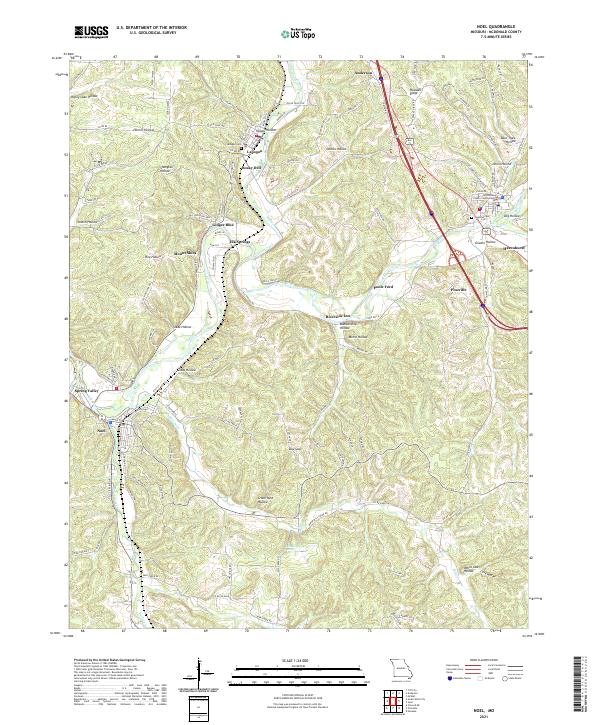
2021 Map of Noel
USGS Topo · Published 2021About this map
McDonald County Courthouse serves as the administrative anchor in Pineville, situated at the convergence of several major regional routes. The landscape is defined by the winding course of the Elk River, which carves through the terrain past small settlements like Ginger Blue, Elk Springs, and Riverside Inn. The distribution of these communities follows the river valley and the rail corridor, illustrating how water and transit have historically shaped the local economy. In the northern reaches, Anderson and Lanagan sit along Indian Creek, while southern areas near Noel are marked by a high density of named hollows such as Crane Nest Hollow and White Oak Hollow. This mapping captures the contemporary layout of McDonald County, from the formal civic center in Pineville to the scattered rural landings and springs like Deer Lick Spring that characterize the Ozark foothills.
Find a feature on this map
119 named features on this map. Tap any name to fly to it.
Don’t see what you’re looking for? This feature index may not catch every label — zoom into the map to look around manually.
Map Details
Editions of this 2021 Noel Map
This is the sole edition of this map. No revisions or reprints were ever made.
Historical Maps of Mount Shira Through Time
4 maps found