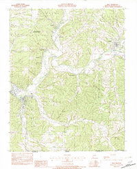
1982 Map of Noel
USGS Topo · Published 1982About this map
The Elk River winds through the southwestern corner of McDonald County in the early 1980s, creating a corridor of recreation and small-town Missouri life. This area, just north of the Missouri Arkansas border, is defined by the confluence of Big Sugar Cr and Little Sugar Cr near Pineville, which flow together to form the main river. The landscape is deeply carved by countless hollows, such as Shanghai Hollow and Happy Hollow, suggesting the intricate drainage system of the Ozark Plateau.
Find a feature on this map
44 named features on this map. Tap any name to fly to it.
Don’t see what you’re looking for? This feature index may not catch every label — zoom into the map to look around manually.
Map Details
Editions of this 1982 Noel Map
This is the sole edition of this map. No revisions or reprints were ever made.
Other maps of this area

1899 · Fayetteville
USGS Topo · 1:125,000

1899 · Siloam Springs
USGS Topo · 1:125,000

1901 · Fayetteville
USGS Topo · 1:125,000

1903 · Siloam Springs
USGS Topo · 1:125,000

1904 · Siloam Springs
USGS Topo · 1:125,000

1904 · Fayetteville
USGS Topo · 1:125,000

1907 · Wyandotte
USGS Topo · 1:125,000

1909 · Wyandotte
USGS Topo · 1:125,000

1940 · Noel
USGS Topo · 1:62,500

1943 · Noel
USGS Topo · 1:62,500