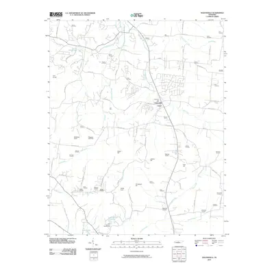
2010 Map of Nolensville
USGS Topo · Published 2010About this map
Nolensville serves as the focal point of this Tennessee landscape, where the town's expansion is evident through modern residential developments and the established Nolensville Post Office. The area is defined by its dramatic topographic relief, featuring prominent elevations such as Holt Knobs, McMahan Knob, and Chinquapin Hill. This survey provides an extensive record for genealogists, documenting over twenty burial sites including the Battle Cemetery, Chrisman Cemetery, and Vernon Cemetery.
Find a feature on this map
89 named features on this map. Tap any name to fly to it.
Don’t see what you’re looking for? This feature index may not catch every label — zoom into the map to look around manually.
Map Details
Editions of this 2010 Nolensville Map
This is the sole edition of this map. No revisions or reprints were ever made.
Other maps of this area

1903 · Nashville
USGS Topo · 1:125,000

1909 · Franklin
USGS Topo · 1:62,500

1932 · Hermitage
USGS Topo · 1:62,500

1932 · Nashville
USGS Topo · 1:62,500

1936 · Bethesda
USGS Topo · 1:24,000

1942 · Lebanon
USGS Topo · 1:100,000

1946 · Bethesda
USGS Topo · 1:24,000

1949 · Franklin
USGS Topo · 1:24,000
1949 · Bethesda
USGS Topo · 1:24,000

1952 · La Vergne
USGS Topo · 1:24,000