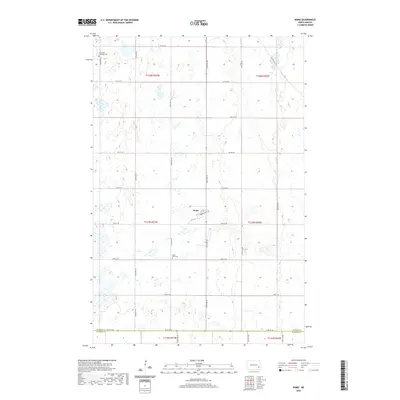
2020 Map of Nome
USGS Topo · Published 2020About this map
Nome serves as the central hub of this prairie landscape, where the grid of Main St and 1st St N meets the rural road network. The surrounding terrain is defined by a dense concentration of wetlands and small water bodies that break up the agricultural squares of the Public Land Survey System. Genealogical interest is anchored by two distinct burial sites: Immanuel Lutheran Cem to the northwest and Saint Petri Cem further south. These landmarks, along with the section-line roads like Co Hwy 38 and 54th St SE, which marks the boundary between Barnes Co and Ransom Co, illustrate the settlement pattern of eastern North Dakota in the early 21st century.
Find a feature on this map
29 named features on this map. Tap any name to fly to it.
Don’t see what you’re looking for? This feature index may not catch every label — zoom into the map to look around manually.
Map Details
Editions of this 2020 Nome Map
This is the sole edition of this map. No revisions or reprints were ever made.
Other maps of this area

1897 · Tower
USGS Topo · 1:125,000

1953 · Fargo
USGS Topo · 1:250,000

1956 · Fargo
USGS Topo · 1:250,000

1965 · Lucca
USGS Topo · 1:24,000

1965 · Tower City SW
USGS Topo · 1:24,000

1967 · Ft. Ransom
USGS Topo · 1:24,000

1967 · Fingal
USGS Topo · 1:24,000

1967 · Fingal SW
USGS Topo · 1:24,000
1967 · Nome SE
USGS Topo · 1:24,000
1967 · Nome
USGS Topo · 1:24,000