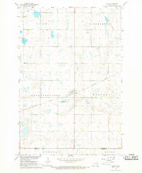
1967 Map of Nome
USGS Topo · Published 1969About this map
The town of Nome serves as the focal point of this Barnes and Ransom County border region during the mid-1960s. Surveyed as part of a development program for the Missouri River Basin, the landscape is defined by its agricultural townships and the Northern Pacific railroad line cutting through the prairie. The map provides a detailed view of rural life through the placement of Immanuel Ch and St Peters Ch, reflecting the early spiritual centers of these farming communities. The terrain is marked by numerous small wetlands and basins, typical of the regional topography, while the Nome Corporate Boundary shows the physical extent of the village at this time. Large township divisions like Thordenskjold and Raritan illustrate the organized land distribution that shaped eastern North Dakota's settlement patterns.
Find a feature on this map
13 named features on this map. Tap any name to fly to it.
Don’t see what you’re looking for? This feature index may not catch every label — zoom into the map to look around manually.
Map Details
Editions of this 1967 Nome Map
This is the sole edition of this map. No revisions or reprints were ever made.
Other maps of this area

1897 · Tower
USGS Topo · 1:125,000

1953 · Fargo
USGS Topo · 1:250,000

1956 · Fargo
USGS Topo · 1:250,000

1965 · Lucca
USGS Topo · 1:24,000

1965 · Tower City SW
USGS Topo · 1:24,000

1967 · Ft. Ransom
USGS Topo · 1:24,000

1967 · Fingal
USGS Topo · 1:24,000

1967 · Fingal SW
USGS Topo · 1:24,000
1967 · Nome SE
USGS Topo · 1:24,000
1967 · Kathryn
USGS Topo · 1:24,000