2024 Map of Nome
USGS Topo · Published 2024About this map
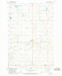
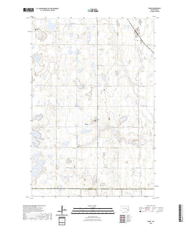
The town of Nome serves as the central hub for this rural Barnes County landscape, where the traditional grid of the Public Land Survey System defines the placement of farms and cemeteries. Local history and genealogy are anchored by sites such as Saint Petri Cem and Immanuel Lutheran Cem, which stand as enduring markers of the area's early settlement. The terrain is characterized by a high density of small wetlands and potholes, many of which are protected within the Barnes County Waterfowl Production Area and the BC Wpa. These conservation areas suggest a landscape where the natural hydrology of the plains is preserved alongside active agriculture. A network of section-line roads, including Co Hwy 38 and 126th Ave SE, connects the scattered farmsteads and provides access to the seasonal water bodies that dot the prairie.
Find a feature on this map
31 named features on this map. Tap any name to fly to it.
Don’t see what you’re looking for? This feature index may not catch every label — zoom into the map to look around manually.
Map Details
Editions of this 2024 Nome Map
This is the sole edition of this map. No revisions or reprints were ever made.