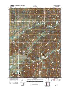
2011 Map of Nonpareil
USGS Topo · Published 2011About this map
English Settlement and the surrounding timberlands of Douglas County are documented here in this 2011 topographic record. The landscape is defined by the winding course of Calapooya Creek and its many tributaries, including Oldham Creek and Long Valley Creek, which carve through the prominent elevations of Robinson Ridge and Hall Ridge. The human footprint in this part of Oregon is sparse but deeply rooted, evidenced by several family and community burial grounds such as Harvey Cemetery, Fair Oaks Cemetery, and Sutherlin Cemetery.
Find a feature on this map
51 named features on this map. Tap any name to fly to it.
Don’t see what you’re looking for? This feature index may not catch every label — zoom into the map to look around manually.
Map Details
Editions of this 2011 Nonpareil Map
This is the sole edition of this map. No revisions or reprints were ever made.
Other maps of this area

1897 · Roseburg
USGS Topo · 1:125,000

1900 · Roseburg
USGS Topo · 1:125,000

1954 · Sutherlin
USGS Topo · 1:62,500

1954 · Drain
USGS Topo · 1:62,500

1954 · Anlauf
USGS Topo · 1:62,500

1954 · Glide
USGS Topo · 1:62,500

1958 · Roseburg
USGS Topo · 1:250,000

1959 · Roseburg
USGS Topo · 1:250,000

1979 · Roseburg
USGS Topo · 1:100,000

1979 · Cottage Grove
USGS Topo · 1:100,000