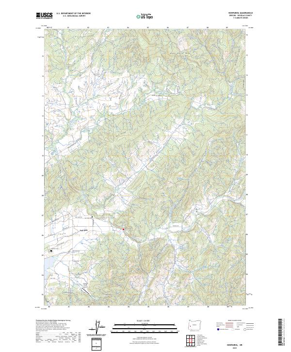
2023 Map of Nonpareil
USGS Topo · Published 2023About this map
Calapooya Creek and its many tributaries wind through this Douglas County landscape, where the small community of Fair Oaks is established at the intersection of several local routes. The presence of the Bonanza Mine and Bonanza Mines in the southern hills points to the region's mineral history, while the surrounding terrain is defined by prominent elevations such as Ben More Mtn and Hall Ridge. Genealogists will find interest in the documented locations of Fair-Oaks Cem and Sutherlin Cem, which anchor the local family history of the area.
Find a feature on this map
62 named features on this map. Tap any name to fly to it.
Don’t see what you’re looking for? This feature index may not catch every label — zoom into the map to look around manually.
Map Details
Editions of this 2023 Nonpareil Map
This is the sole edition of this map. No revisions or reprints were ever made.
Other maps of this area

1897 · Roseburg
USGS Topo · 1:125,000

1900 · Roseburg
USGS Topo · 1:125,000

1954 · Sutherlin
USGS Topo · 1:62,500

1954 · Drain
USGS Topo · 1:62,500

1954 · Anlauf
USGS Topo · 1:62,500

1954 · Glide
USGS Topo · 1:62,500

1958 · Roseburg
USGS Topo · 1:250,000

1959 · Roseburg
USGS Topo · 1:250,000

1979 · Roseburg
USGS Topo · 1:100,000

1979 · Cottage Grove
USGS Topo · 1:100,000