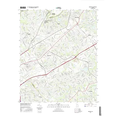
2017 Map of Norcross
USGS Topo · Published 2017About this map
Chattahoochee River National Recreation Area defines the northwestern boundary of this Gwinnett County region, where the river serves as a natural divide from Johns Creek in Fulton County. The landscape is a dense network of suburban growth and major transit arteries, including Peachtree Industrial Blvd and Jimmy Carter Blvd. This 2017 survey shows the area's transition into a major technological and residential corridor, anchored by the planned commercial hub at Technology Park Lake.
Find a feature on this map
43 named features on this map. Tap any name to fly to it.
Don’t see what you’re looking for? This feature index may not catch every label — zoom into the map to look around manually.
Map Details
Editions of this 2017 Norcross Map
This is the sole edition of this map. No revisions or reprints were ever made.
Other maps of this area

1888 · Atlanta
USGS Topo · 1:125,000

1890 · Suwanee
USGS Topo · 1:125,000

1890 · Atlanta
USGS Topo · 1:125,000

1892 · Atlanta
USGS Topo · 1:125,000

1894 · Suwanee
USGS Topo · 1:125,000

1895 · Atlanta
USGS Topo · 1:125,000

1953 · Atlanta
USGS Topo · 1:250,000

1954 · Chamblee
USGS Topo · 1:24,000

1954 · Decatur
USGS Topo · 1:24,000

1955 · Rome
USGS Topo · 1:250,000