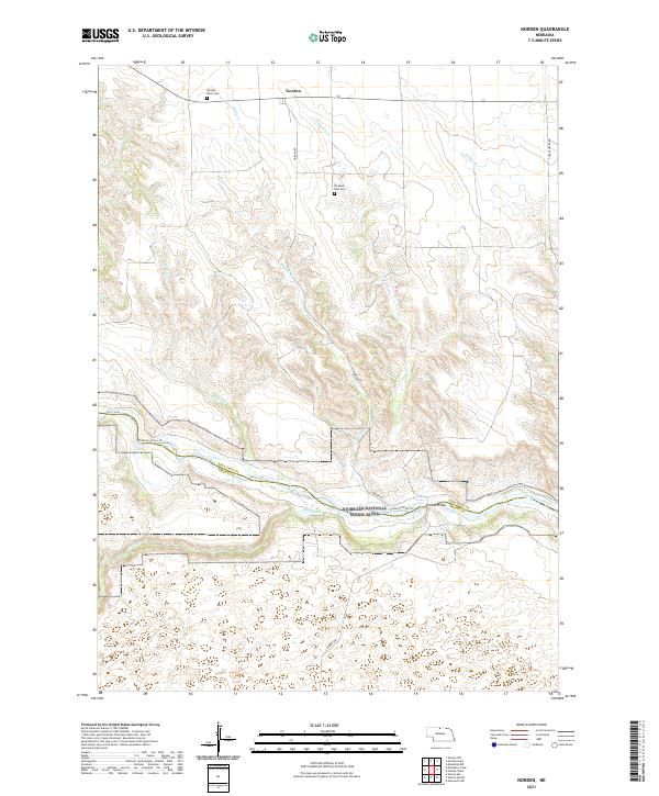
2021 Map of Norden
USGS Topo · Published 2021About this map
Norden sits on the high plains of north-central Nebraska, serving as the primary human landmark in a landscape defined by the deep incision of the Niobrara River valley. This survey illustrates the sharp contrast between the level tablelands and the complex drainage network formed by Middle Cr, E Middle Cr, and McGill Cr. These waterways carve through the terrain as they descend toward the Niobrara National Scenic River, a protected corridor that marks the boundary between Keya Paha and Brown Counties. Local history is anchored by the Pleasant Dale Cem and Norden West Cem, while river navigation is noted by specific points like Kuhres Rapid and the Norden Chute. The presence of the Norden Bridge across the river highlights a critical crossing point in this otherwise sparsely populated cattle-ranching region.
Find a feature on this map
24 named features on this map. Tap any name to fly to it.
Don’t see what you’re looking for? This feature index may not catch every label — zoom into the map to look around manually.
Map Details
Editions of this 2021 Norden Map
This is the sole edition of this map. No revisions or reprints were ever made.
Other maps of this area

1950 · Norden
USGS Topo · 1:62,500

1950 · Huddle Table
USGS Topo · 1:24,000

1950 · Wood Lake
USGS Topo · 1:62,500

1952 · Norden
USGS Topo · 1:62,500

1954 · Ainsworth NW
USGS Topo · 1:24,000

1955 · O'Neill
USGS Topo · 1:250,000

1957 · Valentine
USGS Topo · 1:250,000

1959 · Valentine
USGS Topo · 1:250,000

1959 · O'Neill
USGS Topo · 1:250,000
1964 · Meadville NW
USGS Topo · 1:24,000