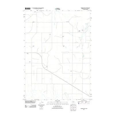
2011 Map of Norden NW
USGS Topo · Published 2011About this map
Sparks Cemetery lies near the western edge of this prairie landscape, serving as a primary point of historical interest in an area defined by large-scale ranching operations. The terrain is marked by the winding courses of Shadley Creek and Coleman Creek, which provide vital water sources for the numerous homesteads scattered throughout the region. The spatial arrangement of these properties, including the Breuklander Ranch, Fullerton Ranch, and Ross Ranch, reflects a persistent agricultural pattern in the early 21st century across the Todd County and Cherry County borderlands.
Find a feature on this map
15 named features on this map. Tap any name to fly to it.
Don’t see what you’re looking for? This feature index may not catch every label — zoom into the map to look around manually.
Map Details
Editions of this 2011 Norden NW Map
This is the sole edition of this map. No revisions or reprints were ever made.
Other maps of this area

1950 · Norden
USGS Topo · 1:62,500

1950 · Sparks
USGS Topo · 1:62,500

1952 · Norden
USGS Topo · 1:62,500

1955 · Martin
USGS Topo · 1:250,000

1957 · Valentine
USGS Topo · 1:250,000

1958 · Martin
USGS Topo · 1:250,000

1959 · Valentine
USGS Topo · 1:250,000

1982 · Keyapaha SE
USGS Topo · 1:24,000

1982 · Hidden Timber SE
USGS Topo · 1:24,000
1982 · Keyapaha
USGS Topo · 1:24,000