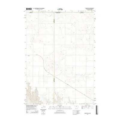
2014 Map of Norden NW
USGS Topo · Published 2014About this map
Sparks Cem sits in the southwestern portion of this 2014 survey, offering a quiet focal point for local history along the Nebraska-South Dakota border. The landscape is defined by its drainages, including the northward-flowing Shadley Cr and the southern Coleman Cr, which carve through the undulating terrain. This map documents a transitional zone where Todd Co, South Dakota, meets Cherry Co and Keya Paha Co, Nebraska. The primary thoroughfare, Ne-12, cuts diagonally across the lower half of the quadrangle, serving as a vital link through this sparsely settled ranching country where large-scale land divisions and intermittent watercourses characterize the geography.
Find a feature on this map
8 named features on this map. Tap any name to fly to it.
Don’t see what you’re looking for? This feature index may not catch every label — zoom into the map to look around manually.
Map Details
Editions of this 2014 Norden NW Map
This is the sole edition of this map. No revisions or reprints were ever made.
Other maps of this area

1950 · Norden
USGS Topo · 1:62,500

1950 · Sparks
USGS Topo · 1:62,500

1952 · Norden
USGS Topo · 1:62,500

1955 · Martin
USGS Topo · 1:250,000

1957 · Valentine
USGS Topo · 1:250,000

1958 · Martin
USGS Topo · 1:250,000

1959 · Valentine
USGS Topo · 1:250,000

1982 · Keyapaha SE
USGS Topo · 1:24,000

1982 · Hidden Timber SE
USGS Topo · 1:24,000
1982 · Keyapaha
USGS Topo · 1:24,000