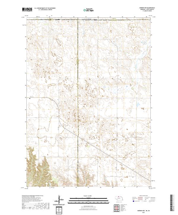
2021 Map of Norden NW
USGS Topo · Published 2021About this map
The South Dakota Nebraska border serves as the northern boundary for this survey, where the rangelands of Cherry and Keya Paha counties meet the southern edges of Todd and Tripp counties. This sparsely populated region is defined by its intermittent watercourses and section-line roads, such as 414th Ave and 416th Ave, which navigate the subtle drainage patterns of Shadley Cr and Coleman Cr. A notable point of historical interest is the Sparks Cem located in the western portion of the sheet. The landscape reveals a pattern of section-based land management, with Clapp Cr winding through the south-central sections. This map documents a quiet, rural interior where infrastructure is limited to essential local connectors like 901st Rd.
Find a feature on this map
16 named features on this map. Tap any name to fly to it.
Don’t see what you’re looking for? This feature index may not catch every label — zoom into the map to look around manually.
Map Details
Editions of this 2021 Norden NW Map
This is the sole edition of this map. No revisions or reprints were ever made.
Other maps of this area

1950 · Norden
USGS Topo · 1:62,500

1950 · Sparks
USGS Topo · 1:62,500

1952 · Norden
USGS Topo · 1:62,500

1955 · Martin
USGS Topo · 1:250,000

1957 · Valentine
USGS Topo · 1:250,000

1958 · Martin
USGS Topo · 1:250,000

1959 · Valentine
USGS Topo · 1:250,000

1982 · Keyapaha SE
USGS Topo · 1:24,000

1982 · Hidden Timber SE
USGS Topo · 1:24,000
1982 · Keyapaha
USGS Topo · 1:24,000