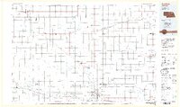
1985 Map of Norfolk
USGS Topo · Published 1986About this map
The Elkhorn River and its numerous tributaries, including the North Fork Elkhorn River, dominate this mid-1980s landscape of Northeast Nebraska. The city of Norfolk serves as the regional hub, housing significant institutional landmarks like the Norfolk Regional Center, Northeast Technical Community College, and the Lutheran Community Hospital. Further east, the influence of Wayne State College is evident in the layout of Wayne.
Find a feature on this map
80 named features on this map. Tap any name to fly to it.
Don’t see what you’re looking for? This feature index may not catch every label — zoom into the map to look around manually.
Map Details
Editions of this 1985 Norfolk Map
2 editions found
Other maps of this area

1898 · Elk Point
USGS Topo · 1:125,000

1901 · Elk Point
USGS Topo · 1:125,000

1907 · Elk Point
USGS Topo · 1:125,000

1954 · Verdigre
USGS Topo · 1:24,000

1955 · Broken Bow
USGS Topo · 1:250,000

1955 · Sioux City
USGS Topo · 1:250,000

1955 · Fremont
USGS Topo · 1:250,000

1955 · O'Neill
USGS Topo · 1:250,000

1956 · Broken Bow
USGS Topo · 1:250,000

1957 · Fremont
USGS Topo · 1:250,000